

Hengill Ultra 106K Route
Hengill Ultra 106K
Short Route description
The longest trail in Hengill Ultra Trail. This one is exclusively for experienced and elite runners.
Registration Fee
- Distance: 106 km.
- Date: June 5, 2026
- Start: 20:00
- Registration fee: ISK 54.500.
- Registration fee until midnight on February 2, 2026: ISK 42.500.
- Registration fee until midnight on October 7, 2025: ISK 35.500.
- Registration ends at 23:59 on May 1, 2026
Included in the Entry Fee:
– Trackers that show runners in real-time.
– Route and safety supervision.
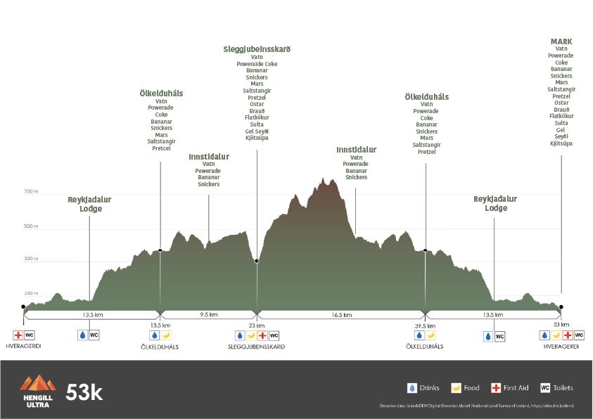
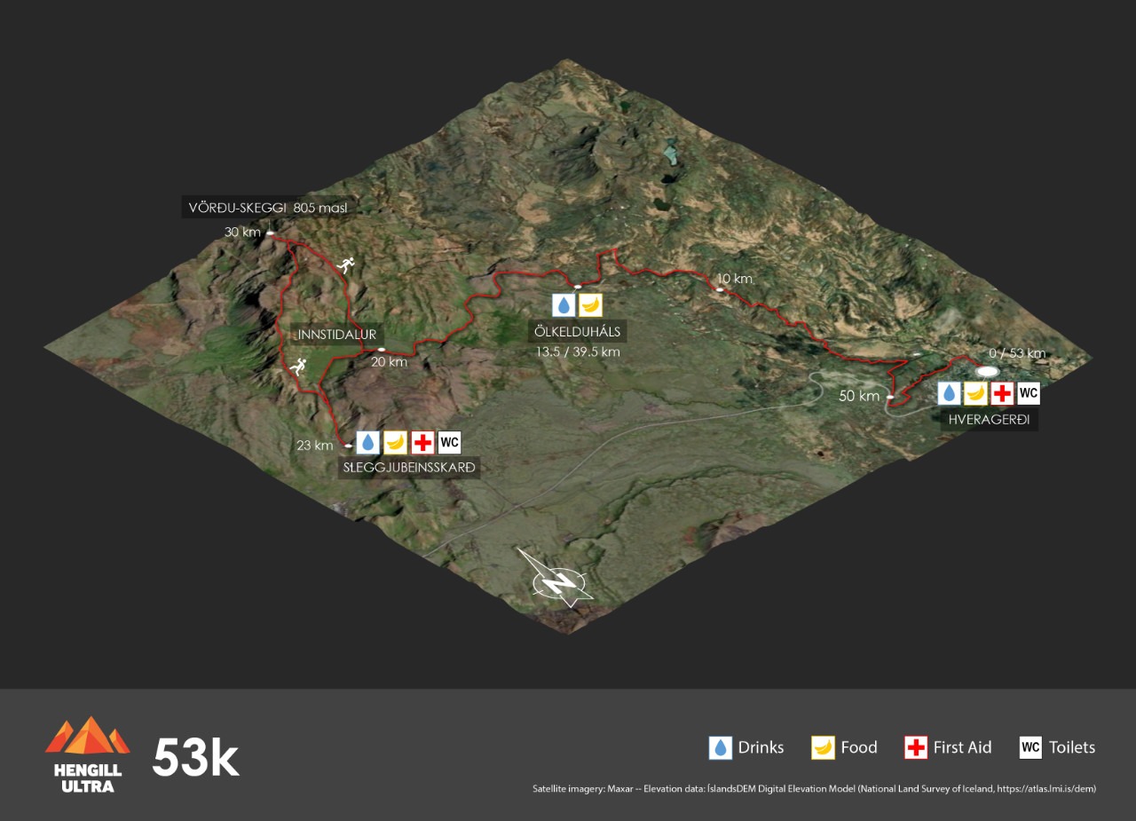
– Drinks and food at checkpoints at Ölkelduháls and Sleggjubeinsskarð.
– Restroom facilities at Ölkelduháls and Sleggjubeinsskarð.
– Dropbag transport to and from Sleggjubeinsskarð
– Grilled burger and a drink at the finish line.
– Participation medal and podium prizes
– Showers and free access to Laugarskarð swimming pool.
– Access to medical and nursing staff in Hveragerði.
– Timing and race number.
– Transport back to town for participants who don’t meet time limits.
**Time Limits:
– First loop: 10 hours.
– Second loop: 12 hours.
– Final cut-off: 22 hours.
Combined elevation is about 4100m
**Mandatory Equipment: As per the race manual.
Elevation profile & drink stations
Route description
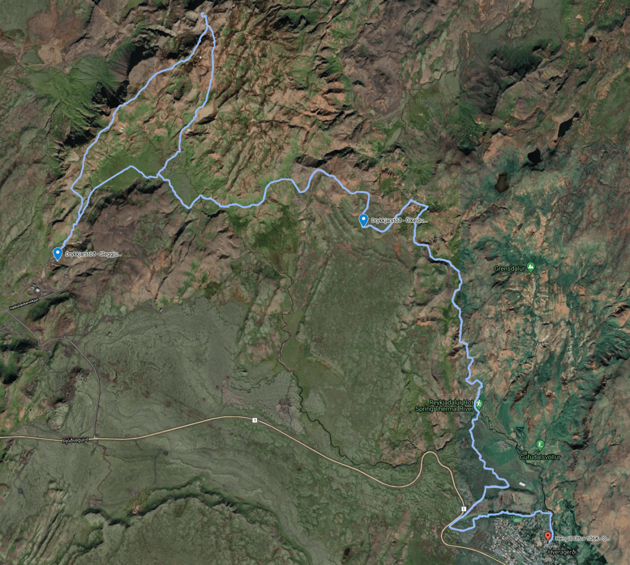
The start of the 106K run is at Breiðumörk, Hveragerði’s main street by the town hall. The route goes past the Skyrgerðin restaurant, through the park, up the ravine by Varmá, past the B&B Frost and Funi, up the hill and over the road towards the Hamar. There you run on a forest path south of the Hamar and up by the lavaside to the old Kambar road below the Hrauntunga cabin. The old road leads then to a horse riding path to the north of the Hamar, parallel to the highway. The path is taken into the valley and towards the sports centre where you encounter a foot path the leads to the parking lot by Varmá and Dalakaffi further into the valley. There you’ll run a marked route up Rjúpnabrekkur and into the Reykjadalur. After that you head towards Klambragil by the warm geothermal spring and out again onto a footpath that leads to Ölkelduháls, until you pass a way-marker that points you towards Sleggjubeinssskarð with blue markers along the way. By the marker you switch onto a lined path that leads to a hydration point.
After the hydration point, you follow the lined path. You continue there through Fremstidalur, Miðdalur, Þrengsli and Innstidalur. When you are at Þrengsli, you take a left turn off the path, over the stream and onto the path the leads into the valley and from that down towards Sleggjubeinsskarð, where there is a hydration point and toilet facilities. From there you run the same way up the pass but you’ll take a left turn onto a black-marked path that runs along the ridge between Innstidalur and Húsmúli. From there you’ll run all the way up to Vörðu-Skeggi which is the highest point of the Hengill area (810m). The view from there is amazing and on a good day you can see the mountain area of the Þingvellir national park and surrounding highlands. From Vörðu-Skeggi you go down the same route but shortly after the descent you’ll continue on a marked path south and run through the heaths of Hengill. You’ll soon encounter a way-marker that points to Innstidalur and you follow that until you arrive at a cabin deep in the valley.
From there you follow the path until you come across the same route you went into the valley. Continue the same route towards the hydration point and to a way-marker by Ölkelduháls. The same path is taken down towards Klambragil. From there you run down Reykjadalur and down into Hveragerði, along the ridge down Árgil towards the park and through the finishing line at Breiðumörk. From there you turn around and run the same loop again.
Remember to carry the obligatory kit with you at all times and be prepared for extreme weather changes and circumstances on this route.
Combined elevation is about 4100m
**Time Limits:
– First loop: 10 hours.
– Second loop: 12 hours.
– Final cut-off: 22 hours.
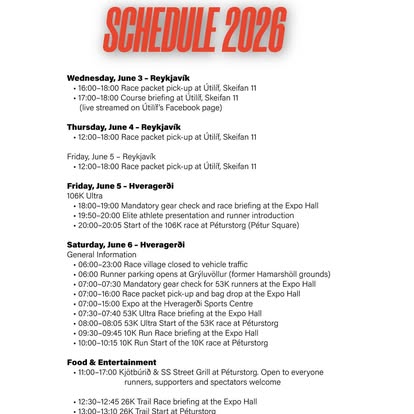
Event details & Car parking
Click here to view the program and event details for Hengill Ultra.
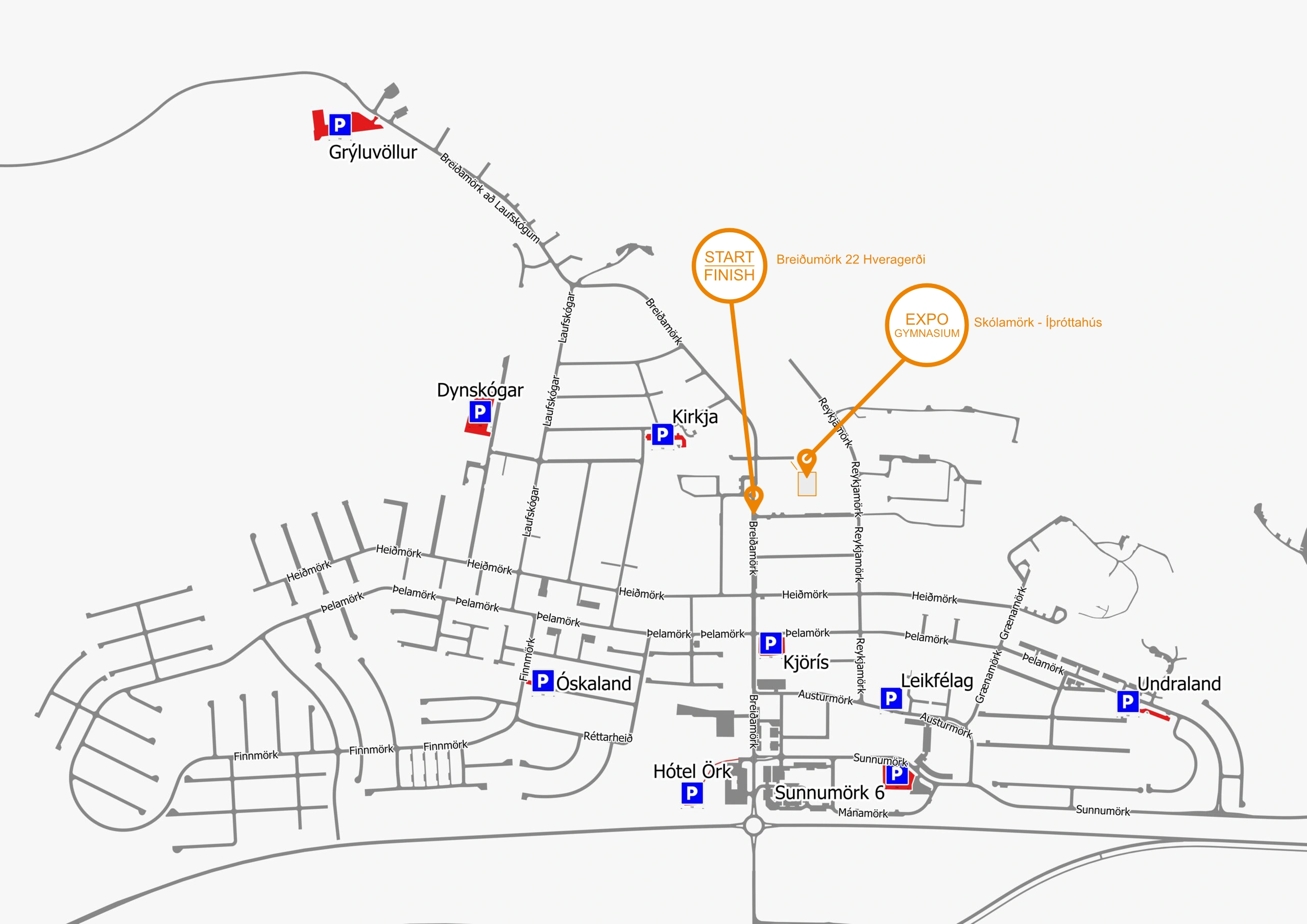
The map below shows the locations of parking spaces in Hveragerði and shows the start/finish line along with the location of the EXPO Gymnasium in the sports hall by Skólamörk street.
The Viking Tournaments
- Hengill Ultra - 5-6 June 2026
- Garmin Eldslóðin - 12 September 2026